2024 Exploration Program Summary
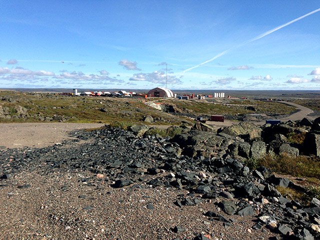
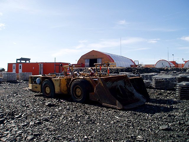
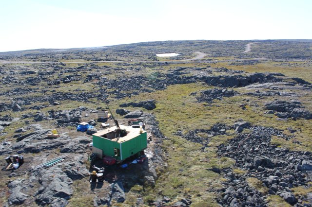
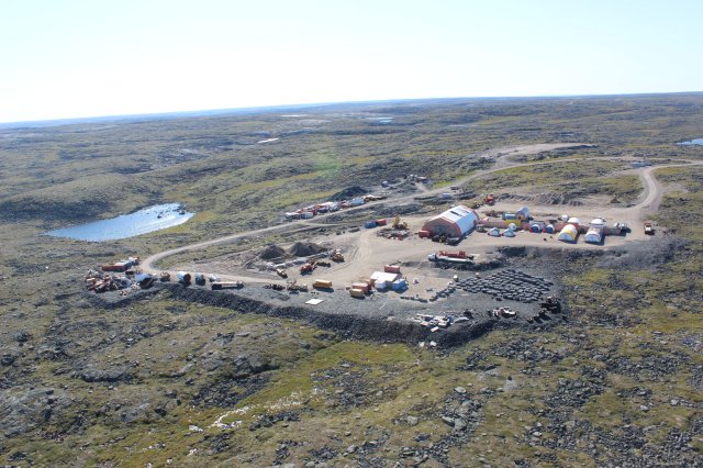
Blue Star mobilized its 2024 exploration program in May and completed the program in September. The program focused on the Company’s Ulu Gold Project and Roma Project in the Kitikmeot region of Nunavut.
Highlights:
- Mobilization of the discovery drill program at Ulu and Roma Projects occurred in May
- Gold focus, with a component of the program dedicated to discovery of critical mineral deposits
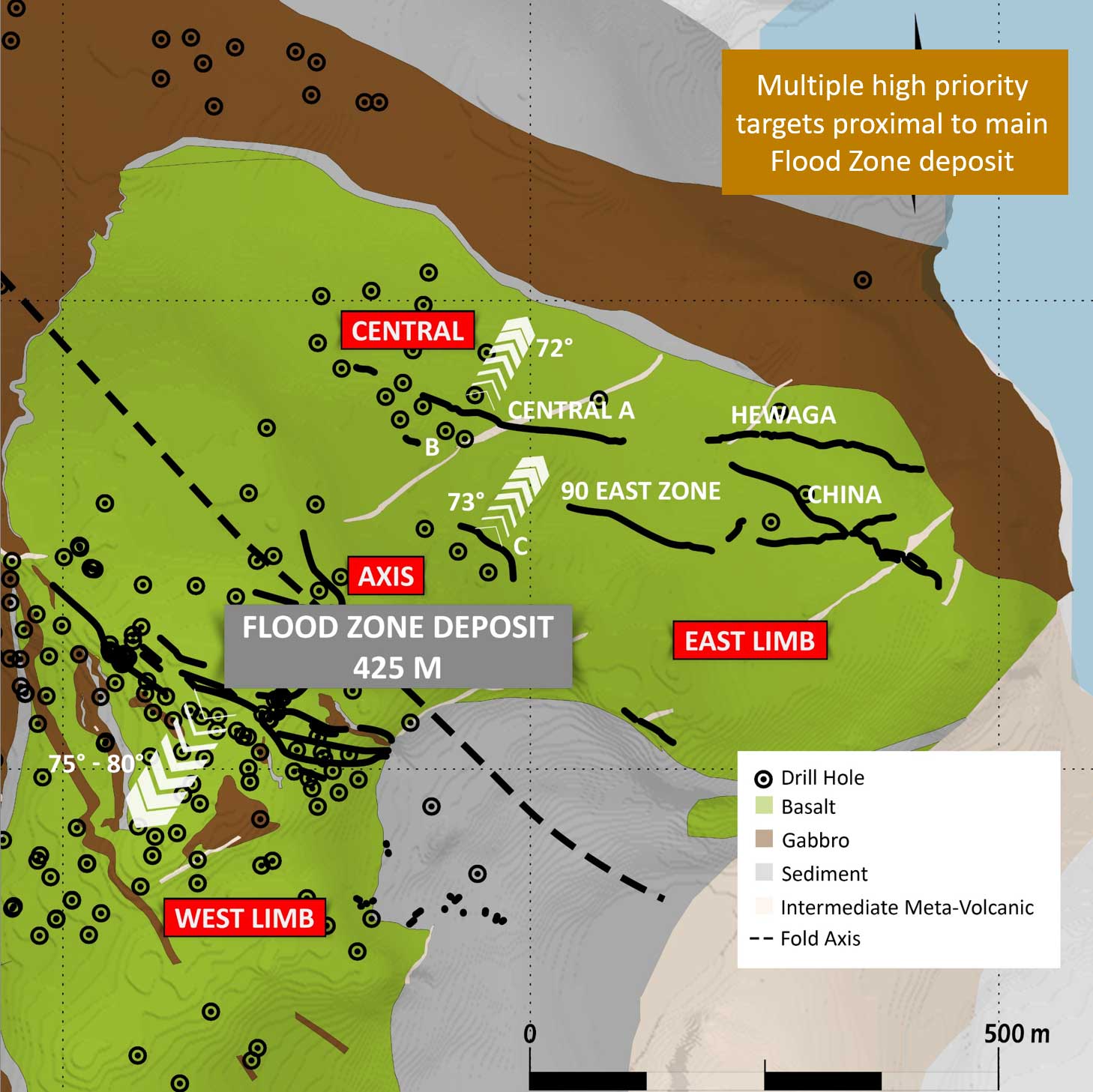
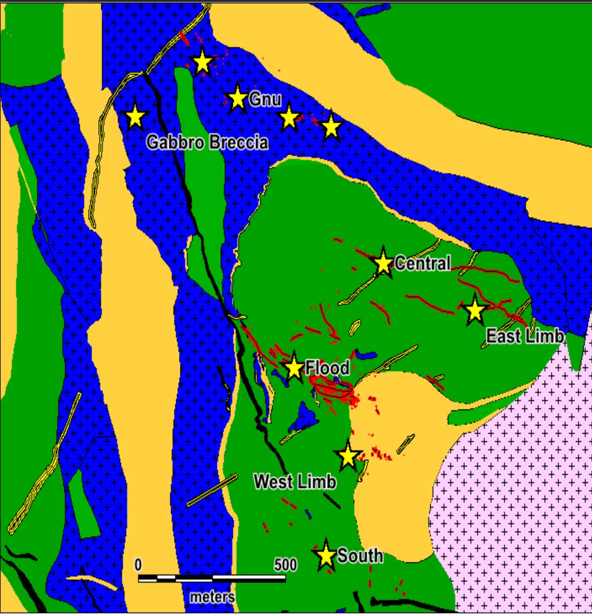
- Priority targets were drilled based on potential for discovery, scale, and proximity to existing resources, including:
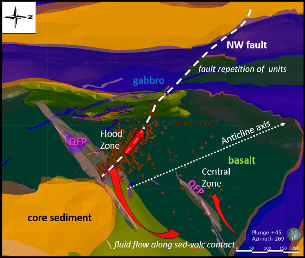
- Evaluation of higher-grade, larger targets within and near the Flood deposit
- Initial drill test of the 2023 Mikigon surface discovery, a new style of mineralization at Ulu
- Testing mineralized structures and targets in the trend that hosts the Gnu deposit
- Other high-potential targets were evaluated (both gold and critical minerals)
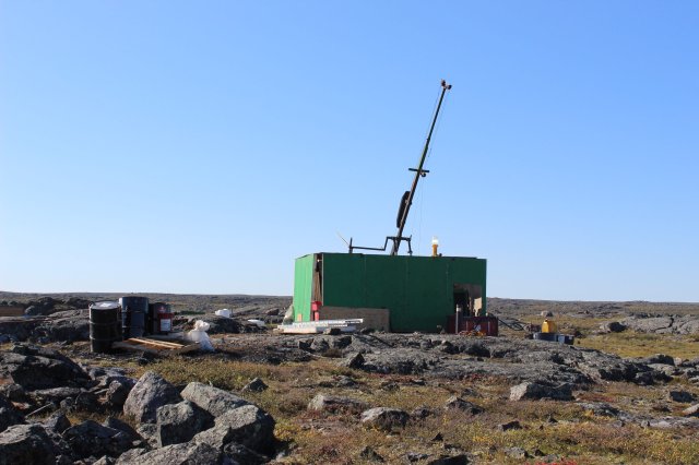
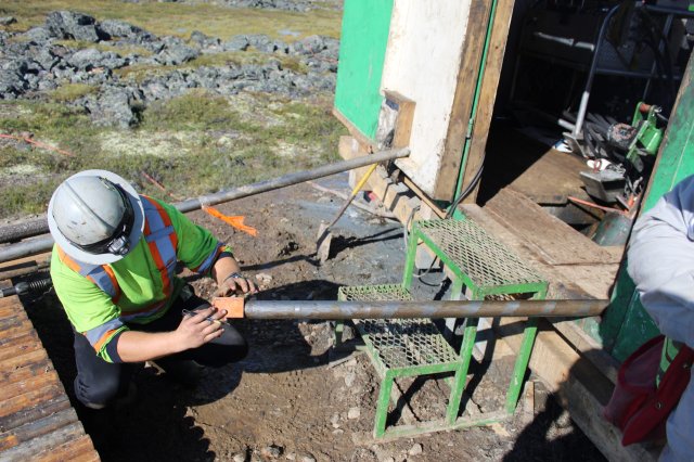
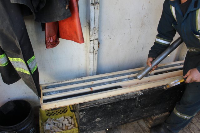
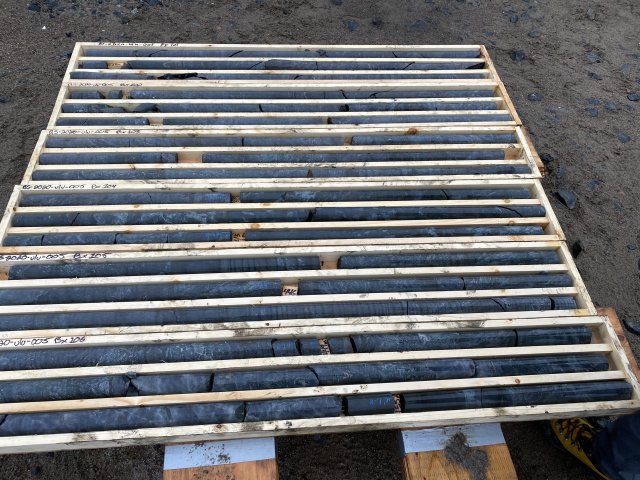
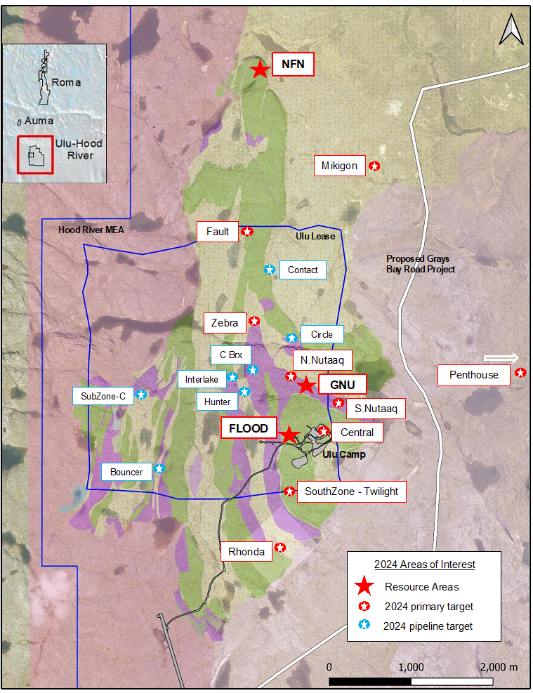
- 16 diamond drill holes for ~4,000 metres across five main target areas were completed, including: HI (Ataani), Mikigon, Penthouse, Gnu Zone (Nutaaq), and the Flood Zone
- Highlights from the Ulu Gold Project drilling:66 g/t gold
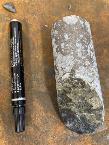
- Targeted Flood Zone structure returned 3.66 metres of 8.46 g/t Au including 1.00 metre of 15.25 g/t Au
- Extended Flood Zone with drillhole intercepts of 9.61 metres of 1.83 g/t Au including 1.36 metres of 3.66 g/t Au, and 3.22 metres of 7.52 g/t Au including 2.01
- Mikigon drilling indicated a pathfinder halo for the system that includes 1+ g/t Au intervals associated with quartz veining, arsenopyrite and elevated bismuth and tellurium values
- Results from drill holes testing both the Nutaaq veins and the inaugural test of the Zebra prospect include:y
- Nutaaq veins returned 17.3 metres of 2.60 g/t Au including 1.0 metre of 23.5 g/t Au, and 6.6 metres of 2.63 g/t Au
- Prospecting samples from the Nutaaq trend returned 23.0, 8.96, 6.03, and 2.49 g/t Au
- Prospecting samples from the Zebra prospect returned grades of 28.1, 14.6, and 5.01 g/t Au
- Inaugural drilling of the Zebra prospect returned encouraging results of 3.6 metres of 1.73 g/t Au including 2.9 metres grading 2.01 g/t Au
The 2023 Exploration Program
Blue Star’s 2023 program included a multi-prong exploration effort across the Company's Ulu Gold Project in Nunavut, including ground-based geophysical surveys, ground-truthing pipeline targets, mapping, lithogeochemical sampling, and prospecting. The program was focused to identify and advance targets throughout Blue Star's highly prospective landholdings to be drill ready for a 2024 discovery program.
Discussion of Field Results
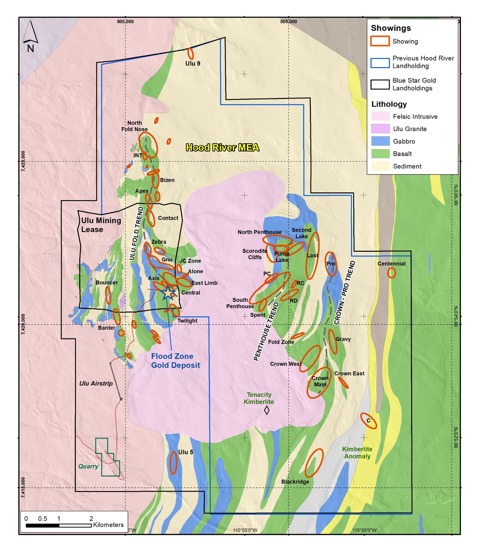
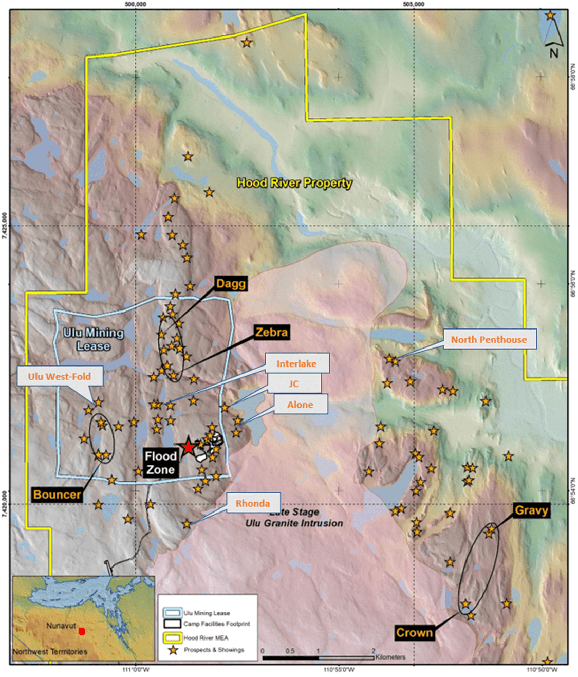
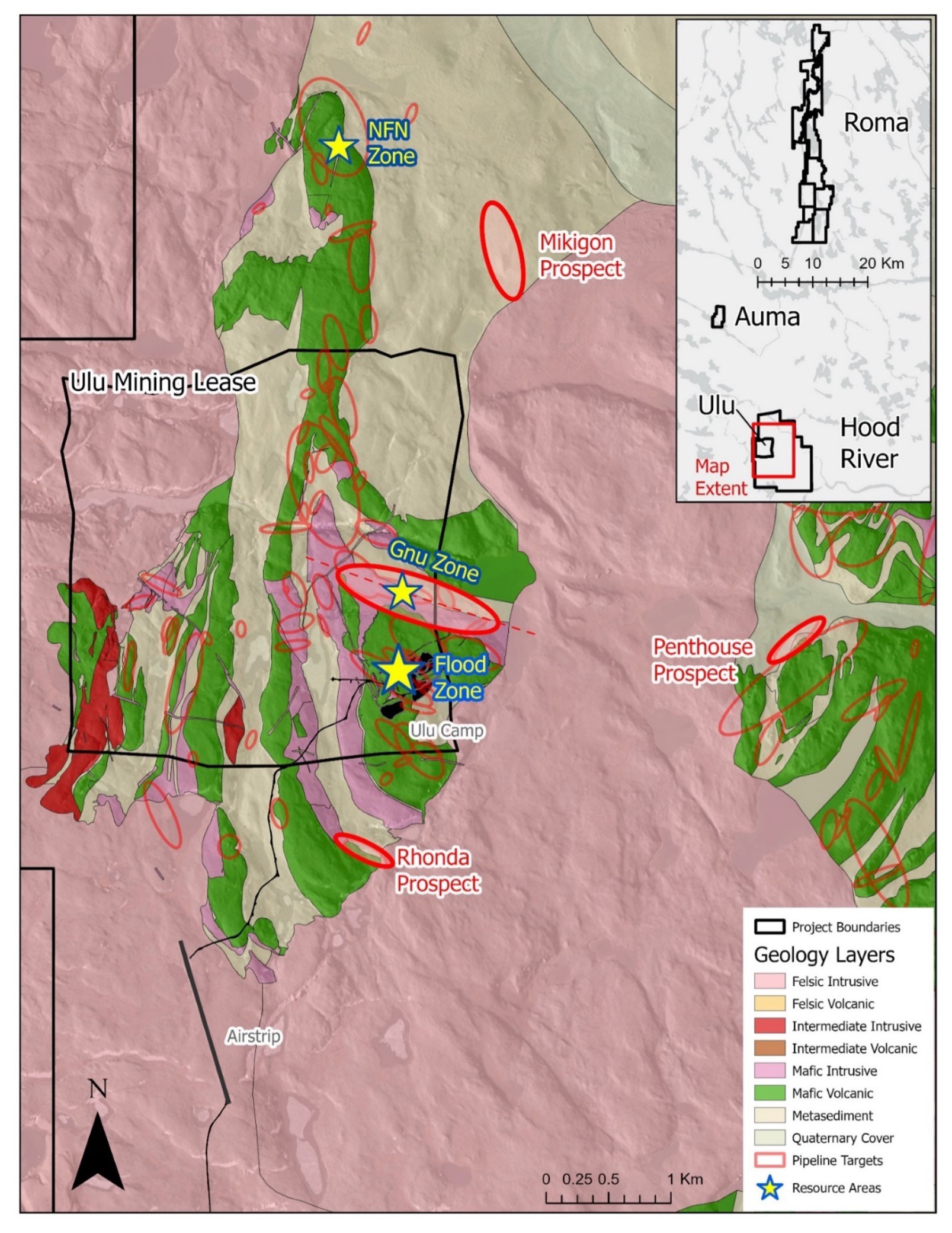
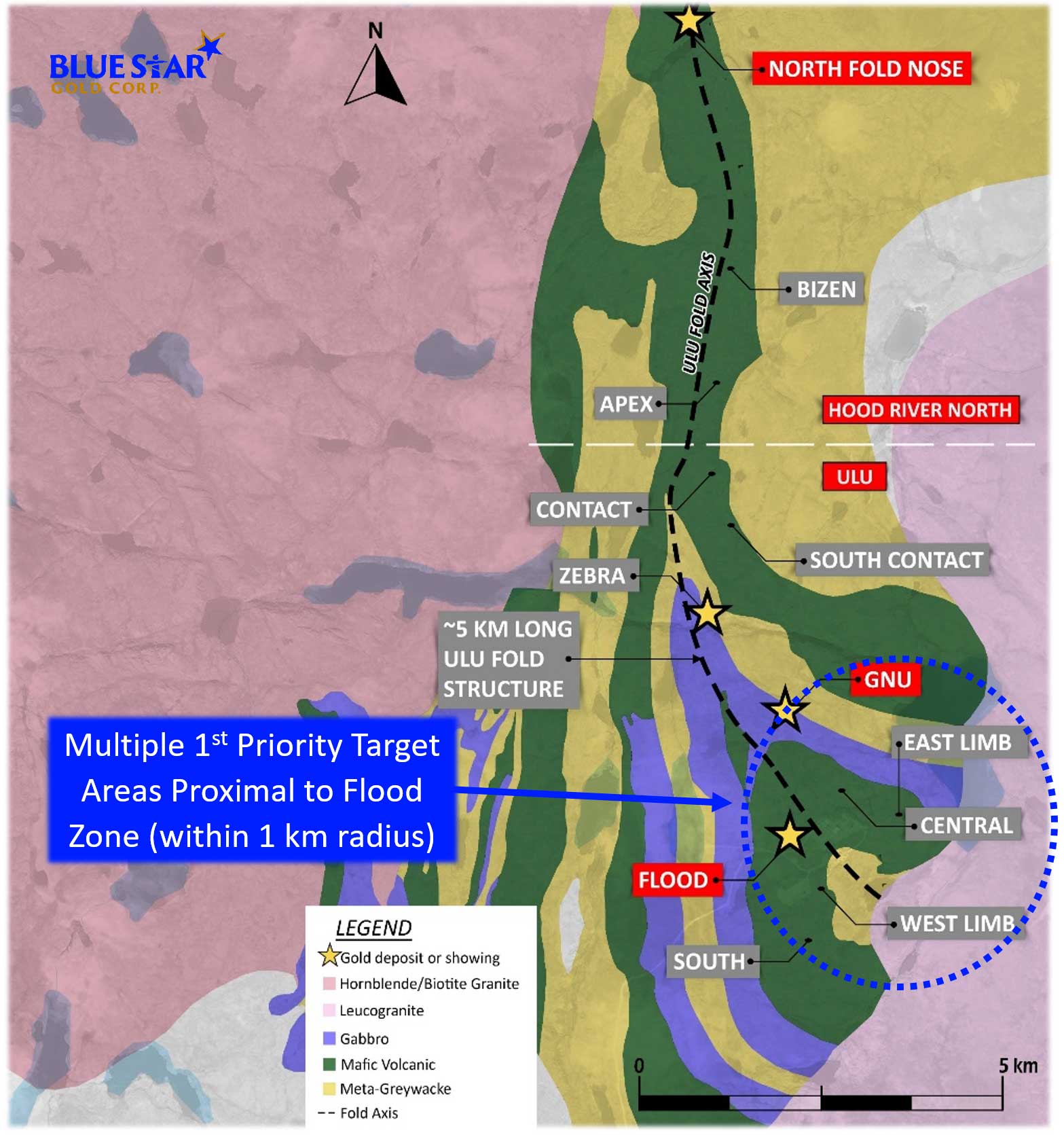
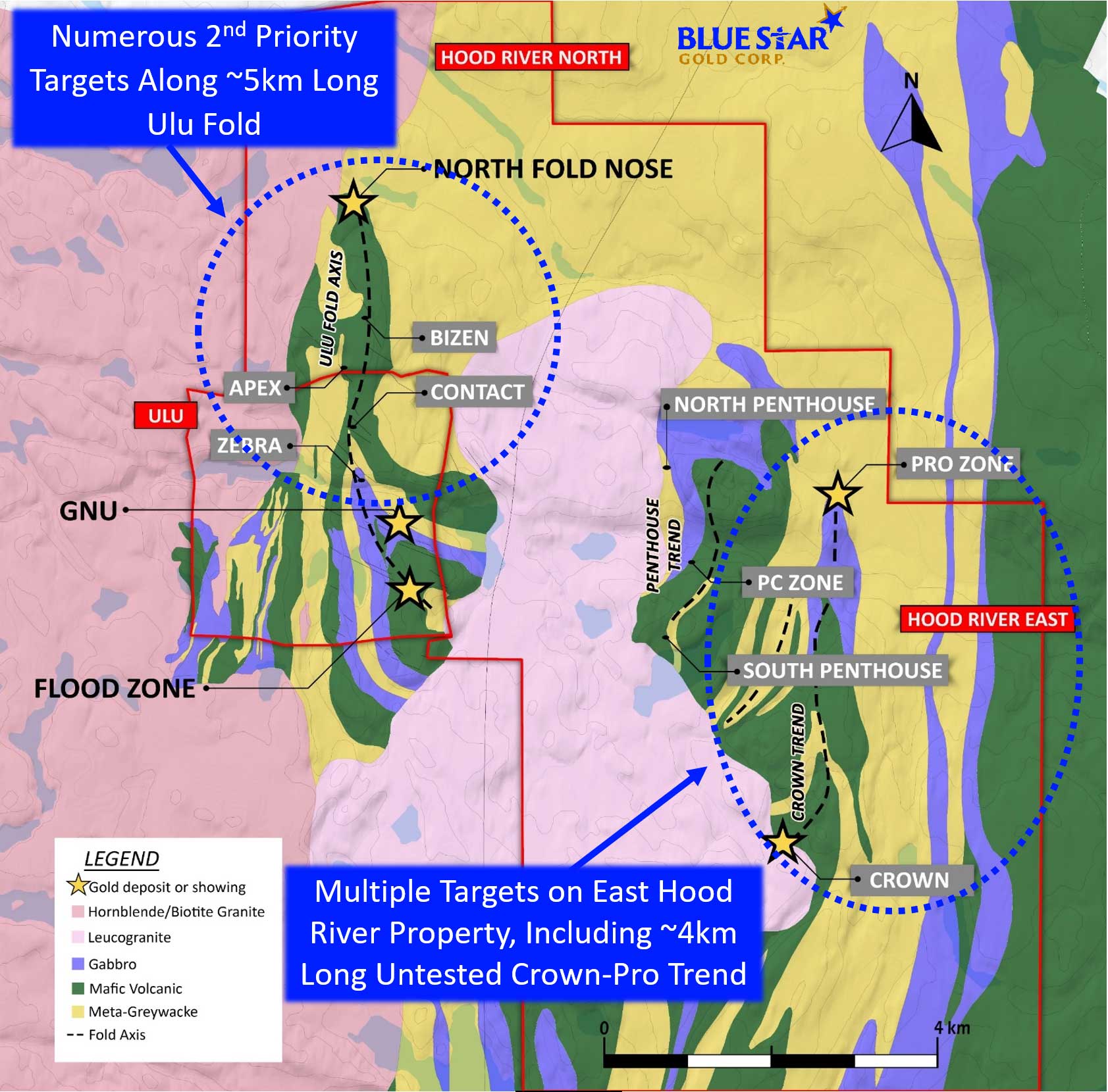
Mapping focussed on the 5 km long Ulu fold between the Flood Zone gold deposit and the NFN deposit, and the North and South Penthouse areas. Mapping was undertaken at scales of 1:5000 and 1:2500, and pXRF scanning of rock chips was used to determine areas for lithogeochemical sampling to better define and understand the stratigraphic package and differentiate between more prospective lithological units. These map areas host many of the key pipeline prospects. Prospectors focused on areas with limited to no previous sampling, and on confirming and expanding known pipeline targets.
The objective of the program was to revisit and evaluate all the historically defined showings in order to better prioritise their potential. Approximately 80% of the pipeline targets have now been revisited, including base metal targets.
A total of 319 samples were collected this season with assay results ranging from detection limit to 47.6 g/t gold. Samples returning > 1 g/t gold made up 22% of the sample population, > 3 g/t represented 11% of the sample population and samples returning > 5 g/t gold comprised 6% of the sample population. Highlights from the pipeline targets reviewed this season are below.
Ulu Fold Trend Targets
Apex/Bizen: 200-300 metre long acicular arsenopyrite bearing alteration zones in mafic volcanic rocks central to the Ulu Fold located 1500-1700 metres south of the NFN resource area. These trends returned 2.81 g/t, 2.72 g/t, 1.91 g/t, and 1.54 g/t gold.
M-Fold: a complexly folded and sheared mafic volcanic package located west of the Ulu Fold hinge and structurally separated from it by a significant shear zone; highlight result was 9.30 g/t gold.
Zebra: this drill target was further defined using detailed magnetics and mapping to better model the zones within and adjacent to a folded gabbro unit, within tightly folded sedimentary rocks, and at the mafic volcanic and sedimentary rock contact. Samples returned include 7.56 g/t and 3.11 g/t gold.
South Zone – Twilight: this area was mapped in detail in preparation for drill testing of the ~400-metre-long trend of alteration and acicular arsenopyrite mineralisation, interpreted to be a parallel structure to that hosting the Flood Zone gold deposit. Limited sampling this season returned up to 3.31 g/t gold.
New Showing: a new gold showing, called the Fault Showing occurs as part of the Mistake-Dagg-Fault trend immediately north and west of the Zebra showing, is located along the western Ulu Fold mafic volcanic contact with sedimentary units. This showing returned values of 13.6 g/t, 3.26 g/t and 1.4 g/t gold associated with acicular arsenopyrite.
Gnu/Nutaaq Trend Targets
JC Zone: this showing is hosted on the eastern limb of the Ulu Fold in the outer mafic volcanic unit. The main part of the zone was covered with a preliminary induced polarisation survey in order to refine potential drill targets within the Gnu/Nutaaq Trend. Results will be available after interpretations are completed.
Central Breccia: several showings in this area are interpreted to be hosted within the same lithological unit which hosts the Gnu/Nutaaq veins 700 metres to the southeast. Samples from sulphide bearing quartz veins returned 5.75 g/t, 5.42 g/t, 4.91 g/t and 2.56 g/t gold.
Ulu West Targets
Interlake: this showing was confirmed to include a combination of two styles of mineralisation; quartz vein hosted gold, and float boulders of massive sulphide material. The former style of mineralisation returned 3.90 g/t and 2.70 g/t gold while the later returned 0.68 g/t gold, 107 g/t silver, 0.2% cobalt, 2.03% lead and 9.84% zinc. The massive sulphide mineralisation is located on the same mafic volcanic/sedimentary rock contact as the Rhonda showing approximately 2200 metres to the south. More detailed mapping and prospecting of this contact and geophysical surveys will refine the target for future drill testing.
Hunter: this showing was expanded with a grab sample returning 7.30 g/t gold. The showing is hosted in the outer mafic volcanic unit of the Ulu Fold proximal to an inferred break between Ulu West and the Ulu Fold. More detailed work is required to better understand the controls of the mineralisation.
Ulu West-Subzone B/C: several metre to multi-metre scale northerly trending strain zones measuring tens to hundreds of metres in length locally host quartz veins with gossanous haloes in this area. Grab sample highlights from a number of these zones include 27.3 g/t gold from black quartz, 7.98 g/t from black-grey quartz with silvery coloured pyrite, and 6.66 g/t gold from a black quartz vein in foliated biotite rich sediments. These zones are characterised by high bismuth values. This area will receive more detailed mapping and geophysical surveys to determine mineralisation controls in order to bring it to drill ready.
The 2022 Exploration Program Highlights
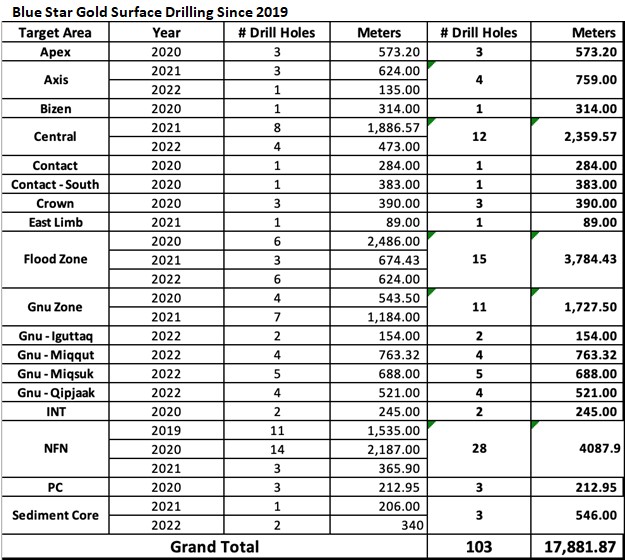
The exploration program consisted of 25 drill holes totalling 3,700 metres in the Gnu (Nutaaq) zone, Central-C, Axis, sediment core and select targets in the Flood Zone. The objective was to test target areas, in particular the expanding Gnu (Nutaaq) zone, and the Central-C and Axis zones, located within a few hundred metres of the Flood Zone gold deposit. All drilling was completed with oriented core to assist in geological modelling.
An additional sampling program of historical core from nine drill holes was undertaken to better determine mineralization boundaries due to unsampled shoulders on some mineralized zones. In addition, a 3,055-line-kilometre airborne geophysics program and a regional till sampling program on the Roma project were conducted. Detailed review and prospecting/mapping of 58 of the targets within the more than 100 compiled pipeline showings were also completed.